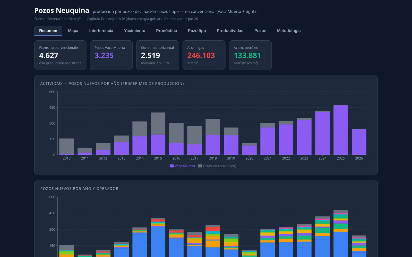
Decline, EUR and type wells by block and operator
Per-well production, Arps fits, and type wells by block and operator. Includes lateral length, spacing, density, and parent-child relationships.
E&P · Neuquén basin & Americas · Open data
Per-well production and decline, recent activity, ground deformation, and emissions by operator. Sources include the SecEnergía well registry, Sentinel-1, and VIIRS.
Cases
Per-well production, Arps fits, and type wells by block and operator. Includes lateral length, spacing, density, and parent-child relationships.
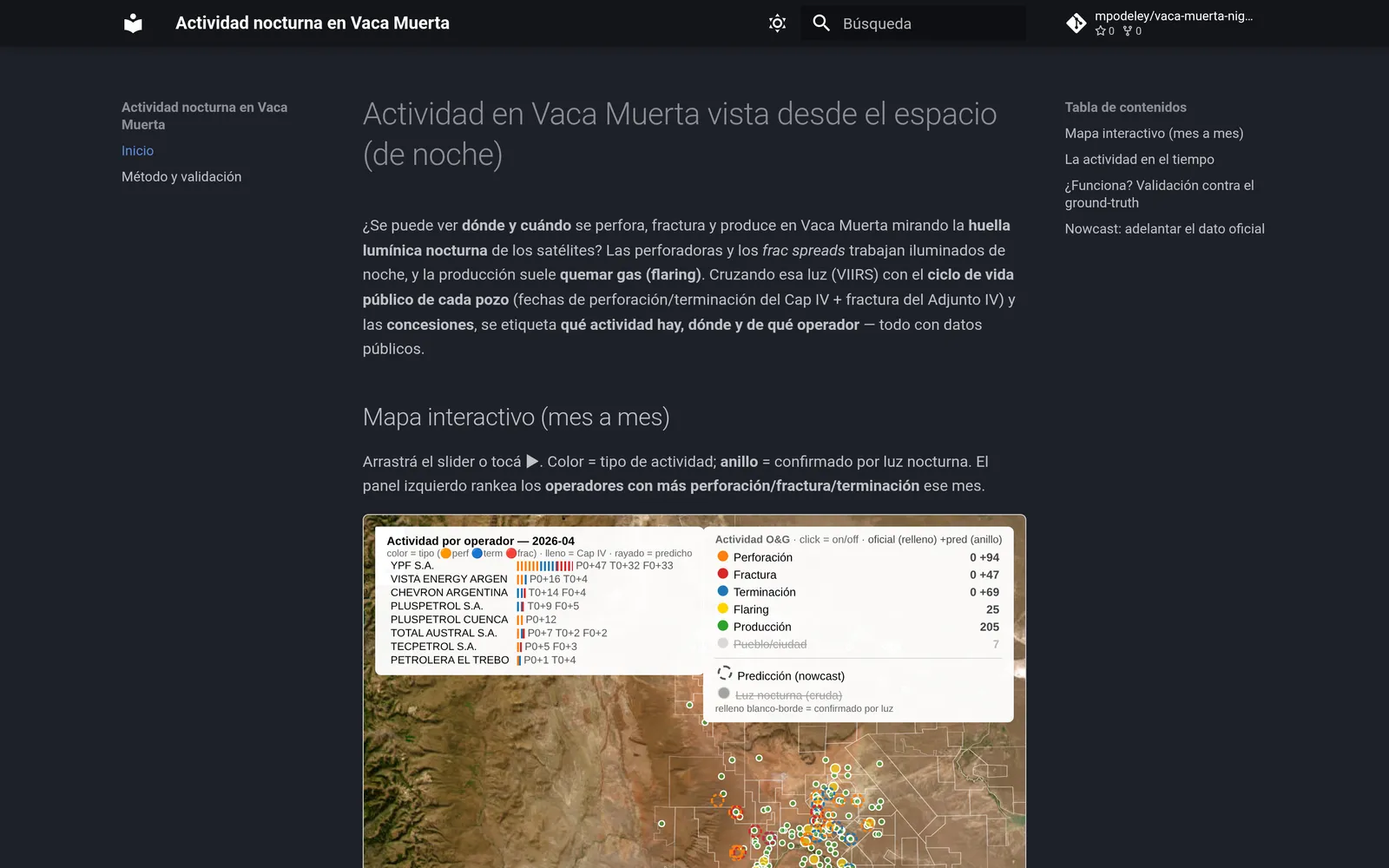
The well registry runs 13.5 months behind. VIIRS confirms 71% of 20,178 well events and estimates the rest at ROC-AUC 0.85 for drilling and 0.91 for fracking. Its 500 m resolution identifies activity at pad scale.
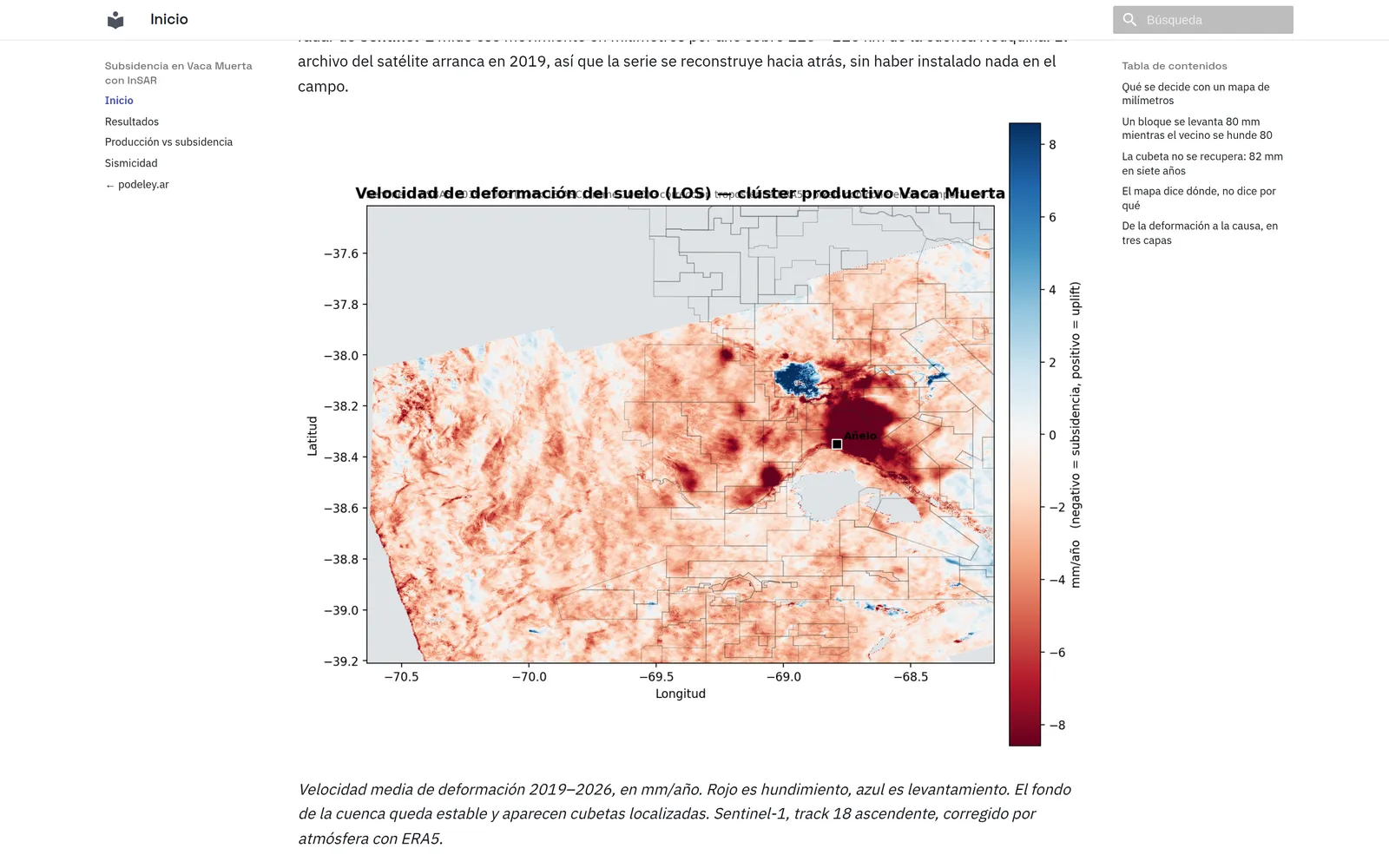
Across two adjacent leases, the injection area rises 80 mm while the producing area sinks 80 mm. The map measures movement and does not identify its cause.
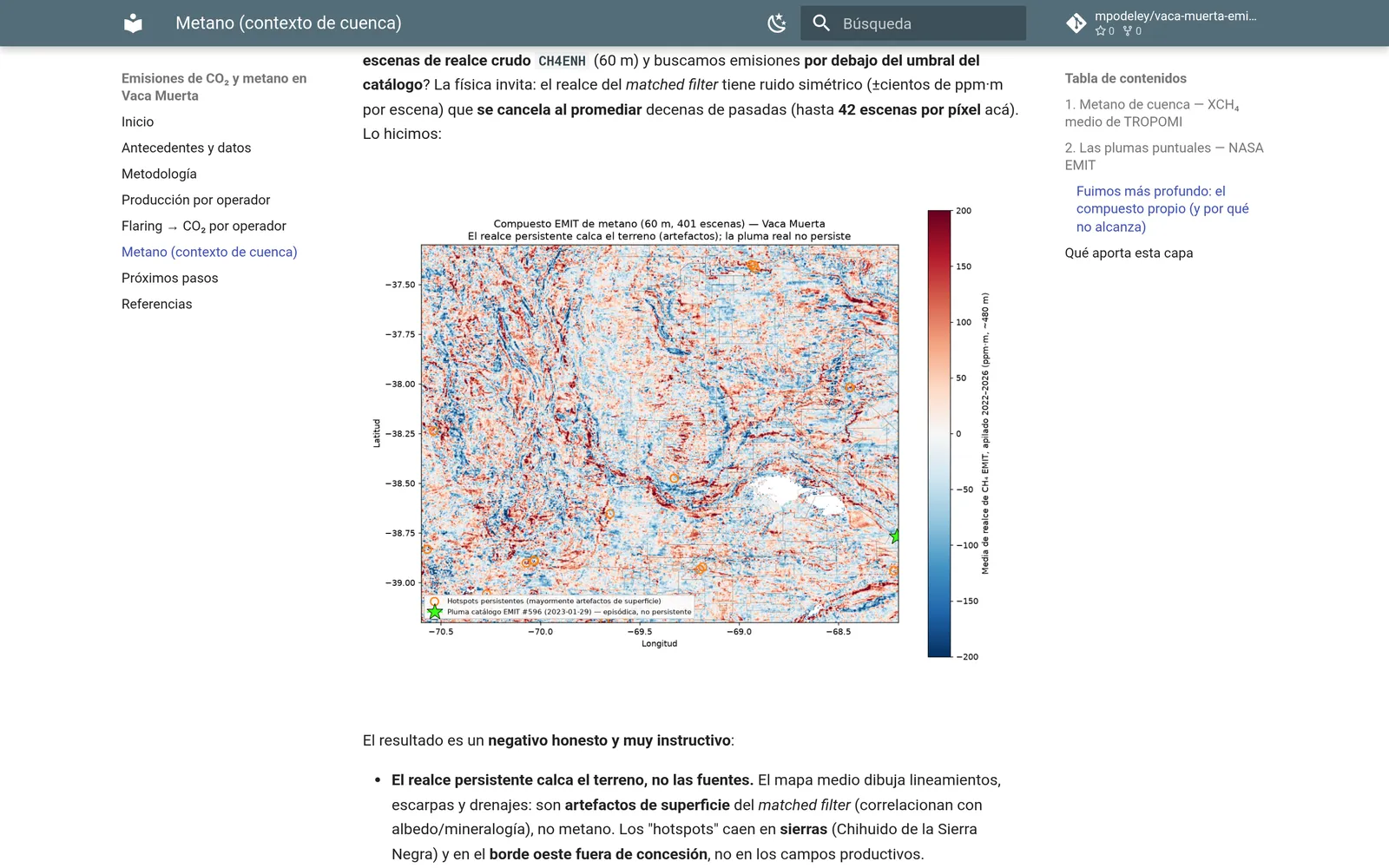
The 2024 data assigns 113 flares and 2.4 Mt of CO₂ to their leases. Intensity ranges from 2.1 to 31.9 kg of CO₂ per barrel of oil equivalent. Methane is measured basin-wide and cannot yet be assigned by company.
Guide to sensors and resolution.
Equipment fleet register: 54 drilling rigs, fifteen frac spreads, and the technical files the industry has published, with a source per figure.
Internal data
The public versions use open records. Internal data can add comparisons between operated wells and offsets, block-level decline against the basin, and deformation over specific pads. See ways to work.
Profile
Matías Podeley. An ITBA engineer, eighteen years in energy: four in operations in Neuquén, simulation of giant fields like Camisea and technical backing of asset purchases above US$ 300 million. Buenos Aires.
Track record in reservoir engineering and project development.
matias@podeley.ar · Buenos Aires