Matías Podeley EN

Mining · Exploration & monitoring · Satellite data

Who holds the ground, where to drill, how much rock moved

Four tools for deciding before you pay: the mining cadastre of six provinces unified into one map, exploration targets blind-validated against known deposits, excavated volume measured from orbit, and lithium salar buildout year by year. All from free public data, with the method left in the open.

Email me See the cases

What it solves

Four decisions currently made blind or by paying for a field campaign

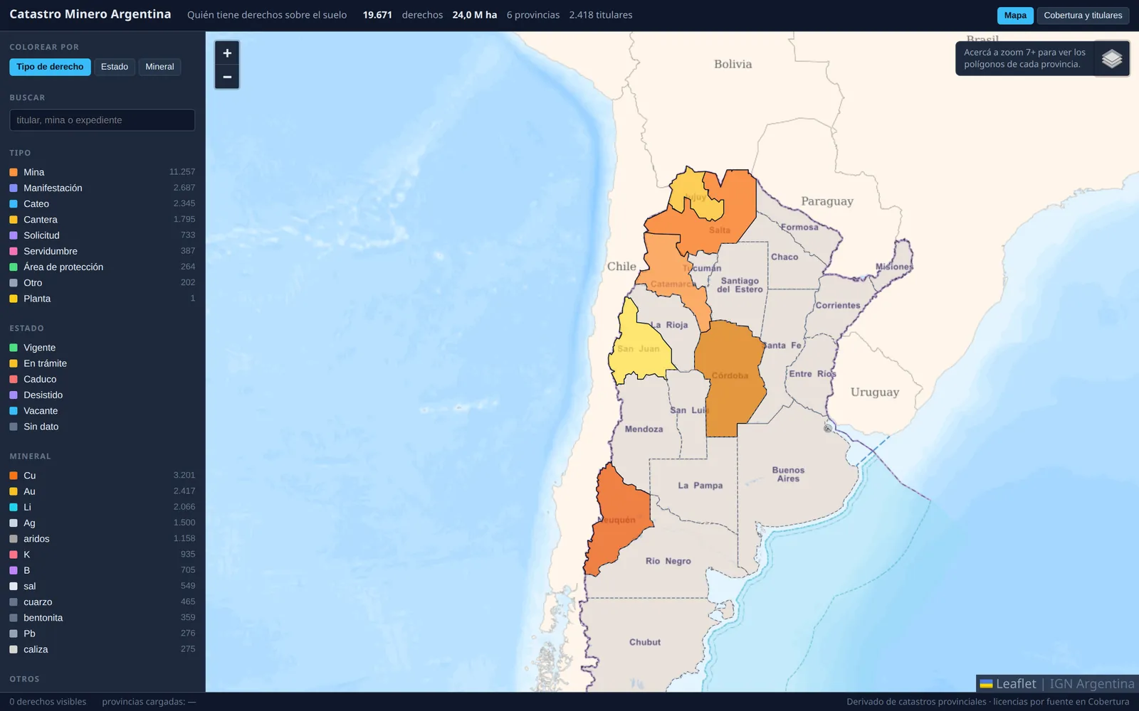
Screenshot: national map of mining tenements by province

Know who holds the ground before making a move

Argentina has no national mining cadastre: each province publishes its own in a different format, and several publish nothing at all. This unifies six into one map — 19,671 tenements, 22 million hectares, 2,418 holders — with the mineral and the file number behind every polygon. San Juan has 66.4% of its territory under mining title, and the provinces that publish nothing are drawn as explicit absence, never as open ground.

Provincial cadastres · 6 provinces · 2026-07Open dataset

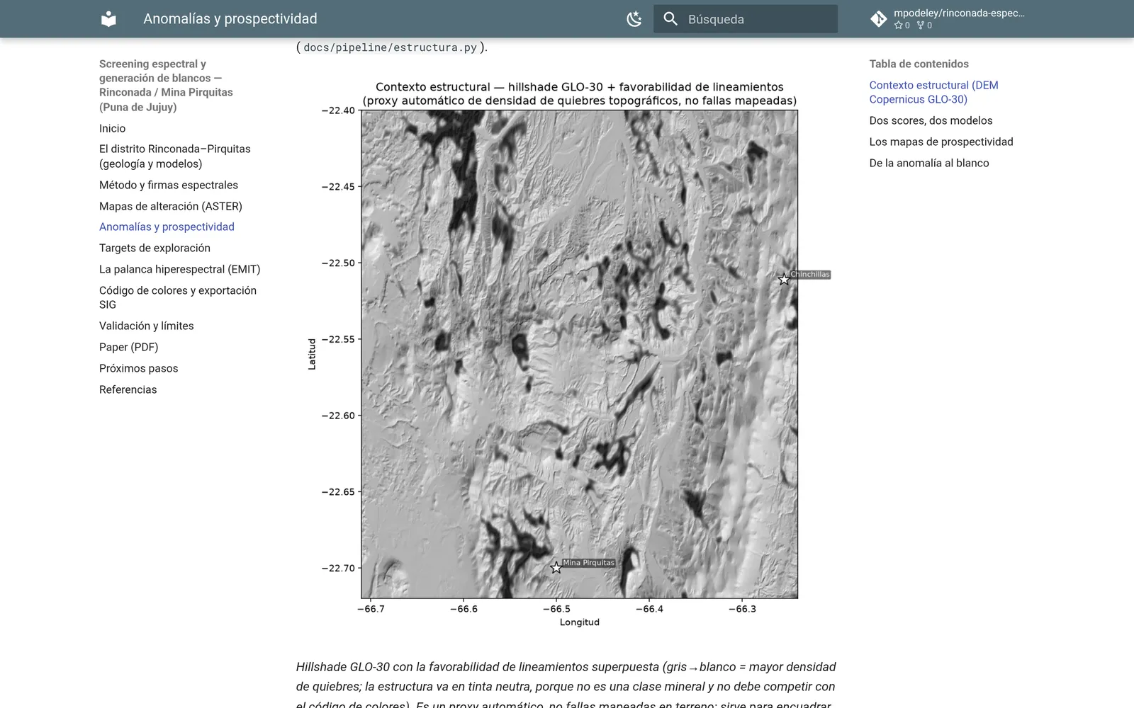
Screenshot: mineral targets from spectrometry

Rank drill targets before paying for the field campaign

The block holds 1,877 km² of usable ground, and screening cuts it to 15 targets with coordinates: reconnaissance stops being a sweep and becomes a visit to a short list. Whether it works is settled blind — the method re-finds Pirquitas and Chinchillas within 20 and 80 meters of the alteration footprint already mapped. The deliverable is shapefile and GeoJSON for your GIS, not a picture.

ASTER + EMIT · 48 × 35 km, Jujuy Puna · 2003 scenePaper

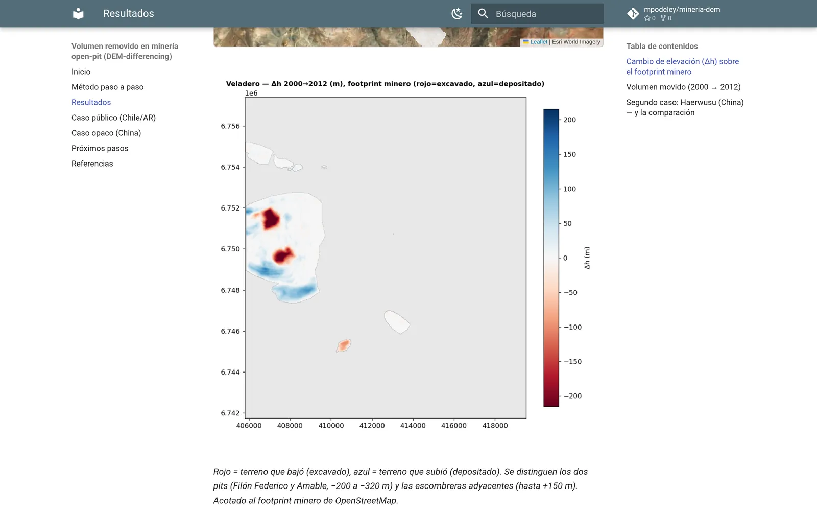
Screenshot: excavated volume from elevation-model differencing

Audit how much rock a mine moved, from the outside

Size up for yourself how much material an operation has moved, before buying into it or financing it. Differencing elevation models from different dates, Veladero gives 424 Mm³ excavated and 497 Mm³ deposited between 2000 and 2024, and there are reports to check that against. At Haerwusu, China's largest open-pit coal mine, no production is declared: the 1,742 Mm³ is the only independent figure that exists.

SRTM 2000 + ASTER stereo · Veladero and Haerwusu · 2000–2024

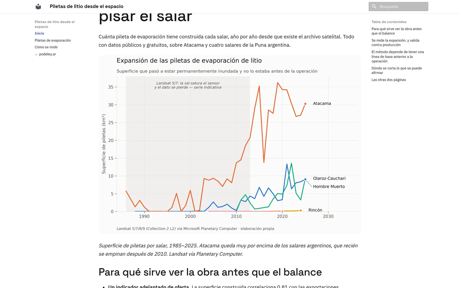
Screenshot: evaporation-pond area by salar, 1985–2025

Track a salar's buildout without setting foot on it

An announced expansion that arrives without ponds under construction gives itself away: the works are large, visible from orbit and dated year by year. Atacama holds 30.3 km² of ponds against 9.0 at Hombre Muerto, and built area correlates 0.81 with declared exports once you lag it two years, which is how long brine takes to work through the pond chain. Area is not production: direct extraction produces with far fewer ponds.

Landsat · Atacama and 4 Puna salars · 1985–2025

Want this over your property or your district? Email me

How I work

Three rules, and a different team on every project

The decision comes first; the satellite comes after, and only if it earns its place.

Everything comes from open sources, so your geologist can walk the whole path back.

If the data won't carry a conclusion, that gets said before the campaign ships, not after.

There is no standing team: one gets built for each project. What I put in is the business read and the development; around that come the technical people the work needs — economic geology, remote sensing, image processing, GIS, programming. Sometimes they're partners of mine and sometimes they're your own crew, which is usually the best thing that can happen: whoever knows the district knows which target is worth walking.

What you get

Three ways to start

Diagnostic

One concrete question about your property, against public data. You come away with a brief document: what shows up, what doesn't, and where every number came from.

Project

The screening, the map or the monitoring over your ground, with whatever team the case calls for. You get back layers ready to drop into your GIS.

Advisory

Ongoing input on what's worth looking at from orbit and what demands boots on the ground, before the campaign budget closes.

Who's behind this

Matías Podeley. Eighteen years in energy — reservoir engineering, then business development, mostly on the side that hires the specialists. I build these tools myself, with public data and AI. Buenos Aires.

Contact

Contact

Tell me which property or district you're deciding on, and I'll tell you what can be seen from orbit.

mpodeley@gmail.com · Buenos Aires